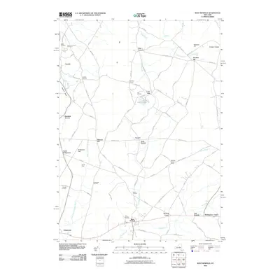
2010 Map of West Winfield
USGS Topo · Published 2010About this map
West Winfield and Bridgewater anchor this central New York landscape where the headwaters of the Unadilla River and the West Branch Unadilla River begin their southward journey. The terrain is defined by the Sauquoit Valley and prominent heights like Wheelock Hill and Dry Hill, creating a network of valleys that historically dictated settlement patterns. Numerous family and community landmarks are preserved here, including the Meeting House Green and several rural burial grounds such as Bardin Cemetery and the Gird Cemetery near Cedar Lake.
Find a feature on this map
86 named features on this map. Tap any name to fly to it.
Don’t see what you’re looking for? This feature index may not catch every label — zoom into the map to look around manually.
Map Details
Editions of this 2010 West Winfield Map
This is the sole edition of this map. No revisions or reprints were ever made.
Other maps of this area

1895 · Oriskany
USGS Topo · 1:62,500

1898 · Utica
USGS Topo · 1:62,500

1898 · Oriskany
USGS Topo · 1:62,500

1900 · Utica
USGS Topo · 1:62,500

1907 · Winfield
USGS Topo · 1:62,500

1907 · Sangerfield
USGS Topo · 1:62,500

1943 · Schuyler Lake
USGS Topo · 1:24,000

1943 · Utica East
USGS Topo · 1:24,000

1943 · Millers Mills
USGS Topo · 1:24,000

1943 · Cassville
USGS Topo · 1:24,000