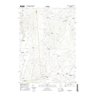
2016 Map of West Winfield
USGS Topo · Published 2016About this map
West Winfield and the surrounding borderlands of Oneida, Herkimer, and Otsego counties reveal a landscape defined by headwater streams and late-twentieth-century rural development. The Unadilla River and its west branch carve through the southern portion of the area, while the Sauquoit Valley marks the northern reaches. This terrain is dotted with small hamlets and significant burial grounds, including the Jerusalem Hill Cem and Meeting House Green Cem, which offer clear points of interest for genealogical research in this corridor of central New York.
Find a feature on this map
106 named features on this map. Tap any name to fly to it.
Don’t see what you’re looking for? This feature index may not catch every label — zoom into the map to look around manually.
Map Details
Editions of this 2016 West Winfield Map
This is the sole edition of this map. No revisions or reprints were ever made.
Other maps of this area

1895 · Oriskany
USGS Topo · 1:62,500

1898 · Utica
USGS Topo · 1:62,500

1898 · Oriskany
USGS Topo · 1:62,500

1900 · Utica
USGS Topo · 1:62,500

1907 · Winfield
USGS Topo · 1:62,500

1907 · Sangerfield
USGS Topo · 1:62,500

1943 · Schuyler Lake
USGS Topo · 1:24,000

1943 · Utica East
USGS Topo · 1:24,000

1943 · Millers Mills
USGS Topo · 1:24,000

1943 · Cassville
USGS Topo · 1:24,000