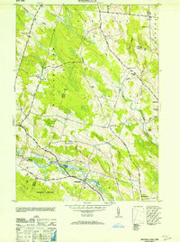
1946 Map of Westdale
USGS Topo · Published 1953About this map
Westdale serves as the primary hub in this mid-century survey of the Oneida County interior, where the West Branch Fish Creek and the New York Central railroad corridor define the local geography. The landscape is characterized by a high density of rural schoolhouses, from School No 2 in the north to Sch No 9 at Westdale, reflecting a distributed settlement pattern typical of the era before district consolidation. The terrain rises toward Maple Hill and Florence Hill, with the winding Mad River and Little River cutting through the eastern uplands near the village of Florence. Genealogists will find notable details in the family-named landmarks and resting places, such as the Johnson Cem near Spellicy and the Graves Cem further east. The road network, including the Military State Road, underscores the historic connectivity between small hamlets and the outlying farmsteads of Redfield and Williamstown.
Find a feature on this map
41 named features on this map. Tap any name to fly to it.
Don’t see what you’re looking for? This feature index may not catch every label — zoom into the map to look around manually.
Map Details
Editions of this 1946 Westdale Map
This is the sole edition of this map. No revisions or reprints were ever made.
Other maps of this area

1903 · Orwell
USGS Topo · 1:62,500

1905 · Orwell
USGS Topo · 1:62,500

1905 · Taberg
USGS Topo · 1:62,500

1906 · Highmarket
USGS Topo · 1:62,500

1906 · Kasoag
USGS Topo · 1:62,500

1942 · Redfield
USGS Topo · 1:24,000

1943 · Redfield
USGS Topo · 1:31,680

1943 · Westdale
USGS Topo · 1:31,680

1943 · Camden West
USGS Topo · 1:31,680

1943 · East Florence
USGS Topo · 1:31,680