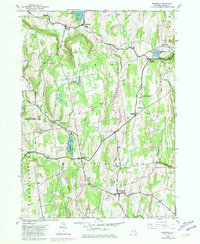
1943 Map of Westerlo
USGS Topo · Published 1981About this map
Helderberg Mountains terrain dominates the eastern portion of this mid-century survey, descending into the valleys of Fox Creek and Switz Kill. This landscape of the northern Catskill foothills is defined by high ridges like Irish Hill and Wolf Hill, which shaped the early agricultural and recreation patterns of the region. The map documents several important crossroads and community centers including Westerlo, East Berne, and Reidsville, while also highlighting early conservation and outdoor recreation areas such as the Partridge Run Game Management Area, Camp Woodstock, and Camp Orinsekwa.
Find a feature on this map
41 named features on this map. Tap any name to fly to it.
Don’t see what you’re looking for? This feature index may not catch every label — zoom into the map to look around manually.
Map Details
Editions of this 1943 Westerlo Map
3 editions found
Other maps of this area

1893 · Coxsackie
USGS Topo · 1:62,500

1893 · Durham
USGS Topo · 1:62,500

1893 · Albany
USGS Topo · 1:62,500

1894 · Coxsackie
USGS Topo · 1:62,500

1894 · Durham
USGS Topo · 1:62,500

1895 · Albany
USGS Topo · 1:62,500

1898 · Albany
USGS Topo · 1:62,500

1900 · Berne
USGS Topo · 1:62,500

1903 · Berne
USGS Topo · 1:62,500

1927 · Albany
USGS Topo · 1:62,500