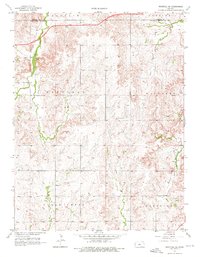
1957 Map of Westfall SE
USGS Topo · Published 1976About this map
East Elkhorn Creek and its tributaries carve through this section of the Kansas plains, marking a landscape defined by its rural townships and early drainage patterns. This 1957 survey captures the intersection of Garfield, Mulberry, and Clear Creek townships during a period of infrastructure development. A notable segment of highway is shown as under construction along the northern border near the Lincoln and Ellsworth County line, signaling the modernization of transit through these prairie stretches.
Find a feature on this map
14 named features on this map. Tap any name to fly to it.
Don’t see what you’re looking for? This feature index may not catch every label — zoom into the map to look around manually.
Map Details
Editions of this 1957 Westfall SE Map
3 editions found
Other maps of this area

1892 · Salina
USGS Topo · 1:125,000

1894 · Ellsworth
USGS Topo · 1:125,000

1942 · Salina
USGS Topo · 1:125,000

1955 · Great Bend
USGS Topo · 1:250,000

1955 · Hutchinson
USGS Topo · 1:250,000

1957 · Great Bend
USGS Topo · 1:250,000

1957 · Ellsworth
USGS Topo · 1:24,000

1957 · Westfall SW
USGS Topo · 1:24,000

1957 · Brookville SW
USGS Topo · 1:24,000

1957 · Westfall SE
USGS Topo · 1:24,000