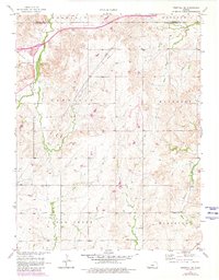
1957 Map of Westfall SE
USGS Topo · Published 1980About this map
East Elkhorn Creek and its numerous tributaries carve through this section of the Kansas prairie, defining the rural landscape along the border of Lincoln and Ellsworth counties. Surveyed in the late 1950s with updates from 1978, the map illustrates a highly organized township system, including Franklin, Garfield, and Carneiro. The region is primarily characterized by its watershed network, with Rock Creek, Table Rock Creek, and Alum Creek draining the central and eastern portions.
Find a feature on this map
15 named features on this map. Tap any name to fly to it.
Don’t see what you’re looking for? This feature index may not catch every label — zoom into the map to look around manually.
Map Details
Editions of this 1957 Westfall SE Map
3 editions found
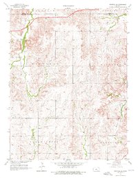
Other maps of this area

1892 · Salina
USGS Topo · 1:125,000

1894 · Ellsworth
USGS Topo · 1:125,000

1942 · Salina
USGS Topo · 1:125,000

1955 · Great Bend
USGS Topo · 1:250,000

1955 · Hutchinson
USGS Topo · 1:250,000

1957 · Great Bend
USGS Topo · 1:250,000

1957 · Ellsworth
USGS Topo · 1:24,000

1957 · Westfall SW
USGS Topo · 1:24,000

1957 · Brookville SW
USGS Topo · 1:24,000

1957 · Westfall SE
USGS Topo · 1:24,000