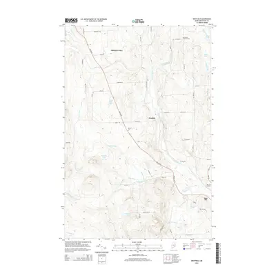
2014 Map of Westfield
USGS Topo · Published 2014About this map
Westfield and the northern outskirts of Mars Hill define this Aroostook County landscape, where the agricultural and timber character of northern Maine is deeply etched into the geography. The town of Westfield serves as a central hub, situated along the path of Houlton Rd, while the surrounding countryside is marked by a network of family-named roads like Cambridge Rd and Tweedie Rd. Water is a defining element of the terrain, with Prestile Stream winding through the eastern portion of the quadrangle and numerous smaller bodies such as Westfield Lake, Youngs Lake, and Eastabrook Lake scattered across the township. For those researching local lineages, the map identifies small burial grounds including Marshall Cem and the Getchell Farnham Cem near Getchell Brook. The presence of the Mars Hill Airport and the distinct elevation of Mars Hill itself emphasize the mix of small-town infrastructure and the prominent natural features of the region.
Find a feature on this map
61 named features on this map. Tap any name to fly to it.
Don’t see what you’re looking for? This feature index may not catch every label — zoom into the map to look around manually.
Map Details
Editions of this 2014 Westfield Map
This is the sole edition of this map. No revisions or reprints were ever made.
Other maps of this area

1934 · Bridgewater
USGS Topo · 1:48,000

1935 · Howe Brook
USGS Topo · 1:48,000

1935 · Presque Isle
USGS Topo · 1:62,500

1936 · Mars Hill
USGS Topo · 1:48,000

1938 · Bridgewater
USGS Topo · 1:62,500

1939 · Howe Brook
USGS Topo · 1:62,500

1940 · Mars Hill
USGS Topo · 1:62,500

1951 · Mars Hill
USGS Topo · 1:62,500

1951 · Bridgewater
USGS Topo · 1:62,500

1953 · Bridgewater
USGS Topo · 1:50,000