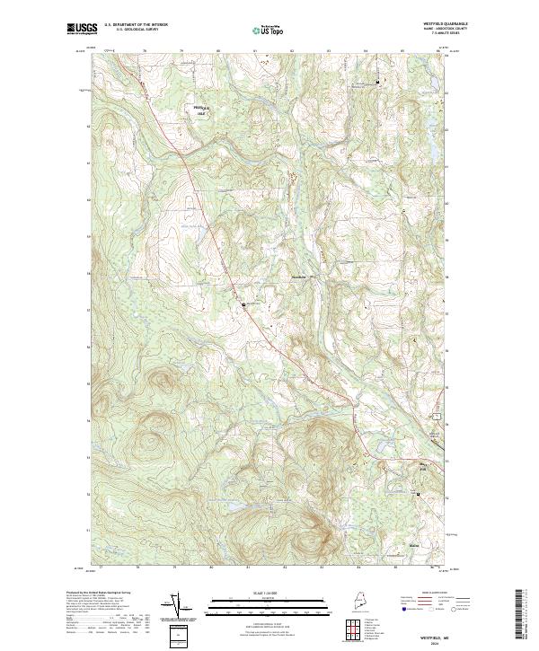
2024 Map of Westfield
USGS Topo · Published 2024About this map
Westfield serves as the central hub of this Aroostook County landscape, where the agricultural and woodland patterns of northern Maine are clearly defined. The terrain is crisscrossed by a network of local roads including Houlton Rd and Cambridge Rd, which connect small settlements and family farms. Significant water bodies like Westfield Lake, Smith Farm Pond, and the Prestile Stream corridor influence the local topography. For those tracing family histories, the map identifies several local burial grounds such as Getchell Farnham Cem and Marshall Cem. To the south, the communities of Mars Hill and Blaine appear near the foothills, while the Mars Hill Airport and the Water District Reservoir mark modern infrastructure developments. The map also captures numerous smaller waterways like Rideout Brook and Youngs Brook, illustrating the drainage patterns that have shaped this potato-growing region.
Find a feature on this map
62 named features on this map. Tap any name to fly to it.
Don’t see what you’re looking for? This feature index may not catch every label — zoom into the map to look around manually.
Map Details
Editions of this 2024 Westfield Map
This is the sole edition of this map. No revisions or reprints were ever made.
Other maps of this area

1934 · Bridgewater
USGS Topo · 1:48,000

1935 · Howe Brook
USGS Topo · 1:48,000

1935 · Presque Isle
USGS Topo · 1:62,500

1936 · Mars Hill
USGS Topo · 1:48,000

1938 · Bridgewater
USGS Topo · 1:62,500

1939 · Howe Brook
USGS Topo · 1:62,500

1940 · Mars Hill
USGS Topo · 1:62,500

1951 · Mars Hill
USGS Topo · 1:62,500

1951 · Bridgewater
USGS Topo · 1:62,500

1953 · Bridgewater
USGS Topo · 1:50,000