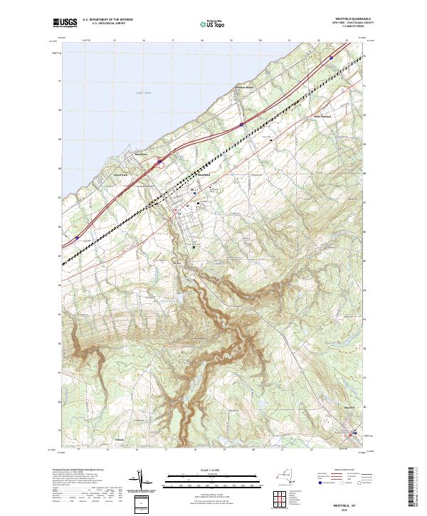
2023 Map of Westfield
USGS Topo · Published 2023About this map
Chautauqua Creek carves a deep path through the center of this landscape, creating a striking topographical feature known as The Gulf as it flows toward Lake Erie. This corridor connects the hilltop town of Mayville, where the Chautauqua County Courthouse stands as a local landmark, to the lakeside settlement of Barcelona. Between these points lies the village of Westfield, a hub of local activity marked by several historical burial grounds including Westfield Cem, Saint James Cem, and Old Saint James Cem. The terrain rises sharply from the lake plains toward the southern highlands near Mount Baldy, where water management is evident at Minton Reservoir and Kent Reservoir. Rural life is further defined by smaller clusters at West Portland and the residential area of Forest Park, tied together by a network of local connectors such as N Portage St and W Lake Rd.
Find a feature on this map
107 named features on this map. Tap any name to fly to it.
Don’t see what you’re looking for? This feature index may not catch every label — zoom into the map to look around manually.
Map Details
Editions of this 2023 Westfield Map
This is the sole edition of this map. No revisions or reprints were ever made.
Other maps of this area

1899 · Westfield
USGS Topo · 1:62,500

1900 · Dunkirk
USGS Topo · 1:62,500

1904 · Chautaqua
USGS Topo · 1:62,500

1905 · Clymer
USGS Topo · 1:62,500

1939 · Clymer
USGS Topo · 1:62,500

1941 · Chautauqua
USGS Topo · 1:62,500

1941 · Clymer
USGS Topo · 1:62,500

1943 · Dunkirk
USGS Topo · 1:62,500

1954 · Chautauqua
USGS Topo · 1:24,000

1954 · South Ripley
USGS Topo · 1:24,000