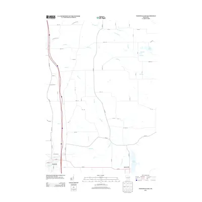
2013 Map of Westfield East
USGS Topo · Published 2013About this map
Harrisville and the eastern outskirts of Westfield anchor this Marquette County landscape, defined by a dense network of glacial waterways and recreational paths. The southern reaches of the quadrangle are dominated by the Montello River, which feeds into Harris Pond, while the northern section is dissected by numerous spring-fed tributaries including Chaffee Cr, Wedde Cr, and its north and south branches. These waterways are interspersed with small glacial lakes such as Imm Lake and Lake Sharon.
Find a feature on this map
42 named features on this map. Tap any name to fly to it.
Don’t see what you’re looking for? This feature index may not catch every label — zoom into the map to look around manually.
Map Details
Editions of this 2013 Westfield East Map
This is the sole edition of this map. No revisions or reprints were ever made.
Other maps of this area

1955 · Green Bay
USGS Topo · 1:250,000

1957 · Madison
USGS Topo · 1:250,000

1958 · Coloma
USGS Topo · 1:48,000

1959 · Wautoma
USGS Topo · 1:48,000

1960 · Madison
USGS Topo · 1:250,000

1961 · Oxford
USGS Topo · 1:62,500

1961 · Montello
USGS Topo · 1:62,500

1968 · Coloma
USGS Topo · 1:24,000

1968 · Richford
USGS Topo · 1:24,000
1968 · Wautoma
USGS Topo · 1:24,000