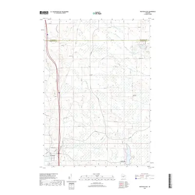
2018 Map of Westfield East
USGS Topo · Published 2018About this map
Harrisville and the eastern outskirts of Westfield anchor this Central Wisconsin landscape along the Montello River. The area is defined by a dense network of glacial water features, including Harris Pond, Lake Sharon, and the winding paths of Chaffee Cr and Wedde Cr. This modern survey reveals the contemporary path of the Ice Age National Scenic Trail as it traverses the northwest corner near the Waushara and Marquette County line. Local heritage is preserved in numerous rural burial grounds, such as Krentz Cem and the Saint Paul Lutheran Cem, which remain as focal points for family history and genealogy. The map shows the transition from village centers to the surrounding wetlands and agricultural plots, intersected by routes like Co HWY B and Co RD E that connect these small-town communities to the broader river system.
Find a feature on this map
65 named features on this map. Tap any name to fly to it.
Don’t see what you’re looking for? This feature index may not catch every label — zoom into the map to look around manually.
Map Details
Editions of this 2018 Westfield East Map
This is the sole edition of this map. No revisions or reprints were ever made.
Other maps of this area

1955 · Green Bay
USGS Topo · 1:250,000

1957 · Madison
USGS Topo · 1:250,000

1958 · Coloma
USGS Topo · 1:48,000

1959 · Wautoma
USGS Topo · 1:48,000

1960 · Madison
USGS Topo · 1:250,000

1961 · Oxford
USGS Topo · 1:62,500

1961 · Montello
USGS Topo · 1:62,500

1968 · Coloma
USGS Topo · 1:24,000

1968 · Richford
USGS Topo · 1:24,000
1968 · Wautoma
USGS Topo · 1:24,000