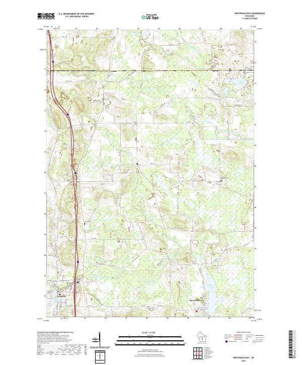
2022 Map of Westfield East
USGS Topo · Published 2022About this map
Westfield and Harrisville anchor this portion of Marquette County, where a dense network of country roads meets the intricate wetlands of central Wisconsin. The landscape is defined by its water, with the Montello River feeding into Harris Pond and the branching waters of Westfield Creek and Chaffee Creek creating a complex drainage pattern across the glacial terrain. For those researching local families, the map identifies several burial grounds including Newton Cemetery, Krentz Cemetery, and East Cemetery, alongside the Saint Paul Lutheran Cemetery to the east.
Find a feature on this map
52 named features on this map. Tap any name to fly to it.
Don’t see what you’re looking for? This feature index may not catch every label — zoom into the map to look around manually.
Map Details
Editions of this 2022 Westfield East Map
This is the sole edition of this map. No revisions or reprints were ever made.
Other maps of this area

1955 · Green Bay
USGS Topo · 1:250,000

1957 · Madison
USGS Topo · 1:250,000

1958 · Coloma
USGS Topo · 1:48,000

1959 · Wautoma
USGS Topo · 1:48,000

1960 · Madison
USGS Topo · 1:250,000

1961 · Oxford
USGS Topo · 1:62,500

1961 · Montello
USGS Topo · 1:62,500

1968 · Coloma
USGS Topo · 1:24,000

1968 · Richford
USGS Topo · 1:24,000
1968 · Wautoma
USGS Topo · 1:24,000