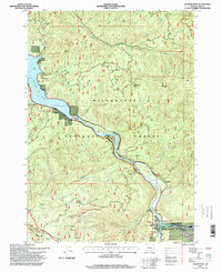
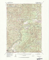
1997 Map of Westfir West
USGS Topo · Published 1998About this map
Willamette National Forest encompasses the majority of this landscape, where the Middle Fork Willamette River carves a deep valley through the Cascades. The 1990s terrain is dominated by steep ridges and peaks such as Tire Mountain and Patterson Mountain, separated by drainage systems like South Fork Winberry Creek and Deception Creek. In the northwest, the map captures the upper reach of Lookout Point Lake near the small settlement of Hampton. To the southeast, the town of Westfir sits at the confluence of the river and Northern railroad line, marked by its corporate boundary and a nearby Mobile Home Park. This survey provides a precise look at the forest's infrastructure during the late twentieth century, including the Oakridge Airport on the southern edge and isolated structures like the Lone Wolf Shelter and Prairie Camp Shelter tucked away in the high country.
Find a feature on this map
38 named features on this map. Tap any name to fly to it.
Don’t see what you’re looking for? This feature index may not catch every label — zoom into the map to look around manually.
Map Details
Editions of this 1997 Westfir West Map
This is the sole edition of this map. No revisions or reprints were ever made.
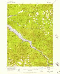
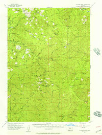
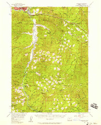
Other maps of this area

1925 · Waldo Lake
USGS Topo · 1:125,000

1935 · Lowell
USGS Topo · 1:96,000

1942 · Lowell
USGS Topo · 1:125,000
1955 · Hardesty Mtn
USGS Topo · 1:62,500
1955 · Fairview Peak
USGS Topo · 1:62,500
1956 · Oakridge
USGS Topo · 1:62,500
1956 · Sardine Butte
USGS Topo · 1:62,500

1958 · Roseburg
USGS Topo · 1:250,000

1959 · Roseburg
USGS Topo · 1:250,000
1983 · Oakridge
USGS Topo · 1:100,000