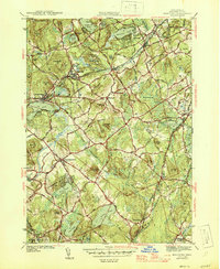
1946 Map of Westford
USGS Topo · Published 1946About this map
Westford serves as a central hub in this mid-1940s landscape, where industrial hamlets like Graniteville and Forge Village are closely tied to the Boston and Maine Railroad. The region is defined by a dense network of glacial ponds and hills, including Nagog Pond, Long Pond, and Millstone Hill. Settlement patterns show concentrated clusters around rail stations such as Brookside Sta and Westford Sta, while the surrounding terrain is crossed by historic routes like Great Road and Littleton Road. Notable landmarks for genealogists and local historians include Fairview Cem and the distinctive intersection at Littleton Common. The map captures the area before modern suburban expansion, preserving the layout of orchards, wetlands like Tadmuck Swamp, and local landmarks like Conscience Hill and Kissacook Hill.
Find a feature on this map
84 named features on this map. Tap any name to fly to it.
Don’t see what you’re looking for? This feature index may not catch every label — zoom into the map to look around manually.
Map Details
Editions of this 1946 Westford Map
2 editions found
Other maps of this area

1886 · Lowell
USGS Topo · 1:62,500

1886 · Framingham
USGS Topo · 1:62,500

1887 · Marlboro
USGS Topo · 1:62,500

1889 · Marlboro
USGS Topo · 1:62,500

1889 · Framingham
USGS Topo · 1:62,500

1893 · Lowell
USGS Topo · 1:62,500

1893 · Groton
USGS Topo · 1:62,500

1894 · Framingham
USGS Topo · 1:62,500

1896 · Marlboro
USGS Topo · 1:62,500

1898 · Marlboro
USGS Topo · 1:62,500