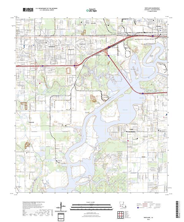
2024 Map of Westlake
USGS Topo · Published 2024About this map
Sulphur and Westlake anchor this 2024 landscape where the intricate waterways of the Calcasieu basin meet industrial and suburban expansion. The map documents the complex hydrography of the Calcasieu River, including the Rose Bluff Cutoff and several low-lying islands like Coon Island and Clooney Island. Settlement patterns are defined by established neighborhoods in Maplewood, Hollywood, and Lockmoor, while the southern reaches near Prien show a high concentration of memorial sites, such as Consolata Cem and Prien Memorial Park Cem.
Find a feature on this map
57 named features on this map. Tap any name to fly to it.
Don’t see what you’re looking for? This feature index may not catch every label — zoom into the map to look around manually.
Map Details
Editions of this 2024 Westlake Map
This is the sole edition of this map. No revisions or reprints were ever made.
Other maps of this area

1932 · Moss Lake
USGS Topo · 1:31,680

1932 · Lake Charles NW
USGS Topo · 1:31,680

1932 · Lake Charles SW
USGS Topo · 1:31,680

1935 · Buhler
USGS Topo · 1:31,680

1935 · Moss Bluff
USGS Topo · 1:31,680

1942 · Lake Charles
USGS Topo · 1:62,500

1946 · Moss Lake
USGS Topo · 1:31,680

1947 · Sulphur
USGS Topo · 1:31,680

1947 · Moss Bluff
USGS Topo · 1:31,680

1947 · Sulphur Mines
USGS Topo · 1:31,680