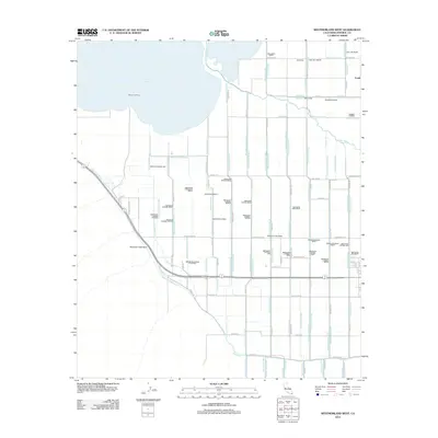
2012 Map of Westmorland West
USGS Topo · Published 2012About this map
The southern shoreline of the Salton Sea dominates this 2012 survey of the Imperial Valley, where the New River empties into the saline basin. This landscape is defined by an intricate network of irrigation infrastructure essential to the region's agricultural economy. The map traces a dense grid of canals, laterals, and drains, including the Vail Canal, Vail Lateral Five, and numerous branches of the Trifolium system such as Trifolium Lateral Nine and Trifolium Twelve Drain.
Find a feature on this map
80 named features on this map. Tap any name to fly to it.
Don’t see what you’re looking for? This feature index may not catch every label — zoom into the map to look around manually.
Map Details
Editions of this 2012 Westmorland West Map
This is the sole edition of this map. No revisions or reprints were ever made.
Other maps of this area

1915 · El Centro
USGS Topo · 1:125,000

1940 · Brawley
USGS Topo · 1:62,500

1940 · Kane Spring
USGS Topo · 1:62,500

1940 · Plaster City
USGS Topo · 1:62,500

1942 · El Centro
USGS Topo · 1:250,000

1943 · Brawley
USGS Topo · 1:62,500

1944 · Plaster City
USGS Topo · 1:62,500

1944 · Kane Spring
USGS Topo · 1:62,500

1944 · Calipatria
USGS Topo · 1:62,500

1954 · El Centro
USGS Topo · 1:250,000