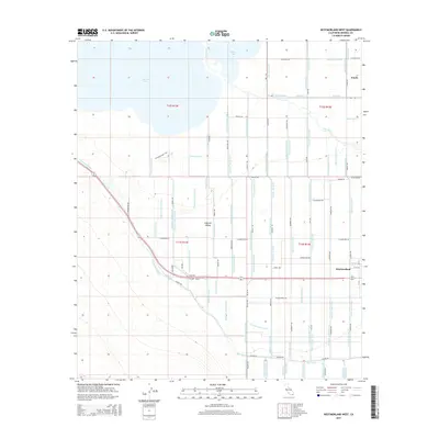
2015 Map of Westmorland West
USGS Topo · Published 2015About this map
Imperial Valley irrigation infrastructure dominates this 2015 survey, revealing the intricate network of canals and drains that support agriculture in the desert southeast of the Salton Sea. The settlement of Westmorland sits at the eastern edge, while the northern extent shows the New River delta as it enters the sea. The landscape is a geometric grid of water management features, including the Tokay Canal, Thistle Canal, and dozens of numbered laterals like Trifolium Lateral Twelve. This system illustrates the engineered hydrology required to sustain the region, with the New River cutting through the center of the valley.
Find a feature on this map
83 named features on this map. Tap any name to fly to it.
Don’t see what you’re looking for? This feature index may not catch every label — zoom into the map to look around manually.
Map Details
Editions of this 2015 Westmorland West Map
This is the sole edition of this map. No revisions or reprints were ever made.
Other maps of this area

1915 · El Centro
USGS Topo · 1:125,000

1940 · Brawley
USGS Topo · 1:62,500

1940 · Kane Spring
USGS Topo · 1:62,500

1940 · Plaster City
USGS Topo · 1:62,500

1942 · El Centro
USGS Topo · 1:250,000

1943 · Brawley
USGS Topo · 1:62,500

1944 · Plaster City
USGS Topo · 1:62,500

1944 · Kane Spring
USGS Topo · 1:62,500

1944 · Calipatria
USGS Topo · 1:62,500

1954 · El Centro
USGS Topo · 1:250,000