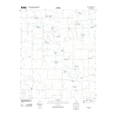
2010 Map of Weston
USGS Topo · Published 2010About this map
Weston and the surrounding rural landscape of Collin County are defined by a sophisticated network of water management features, including dozens of Soil Conservation Service dams. This 2010 survey illustrates a region where agriculture and local history persist alongside evolving drainage systems. Genealogists will find significant value in the distribution of family and community burial grounds, such as Mugg Cemetery, Franklin Cemetery, and Corinth Cemetery, which are scattered across the watershed of Honey Creek.
Find a feature on this map
89 named features on this map. Tap any name to fly to it.
Don’t see what you’re looking for? This feature index may not catch every label — zoom into the map to look around manually.
Map Details
Editions of this 2010 Weston Map
This is the sole edition of this map. No revisions or reprints were ever made.
Other maps of this area

1929 · Frisco
USGS Topo · 1:62,500

1929 · McKinney
USGS Topo · 1:62,500

1954 · Sherman
USGS Topo · 1:250,000

1958 · Sherman
USGS Topo · 1:250,000

1960 · Frisco
USGS Topo · 1:24,000

1960 · McKinney East
USGS Topo · 1:24,000

1960 · Celina
USGS Topo · 1:24,000
1960 · McKinney West
USGS Topo · 1:24,000

1961 · Gunter
USGS Topo · 1:24,000

1961 · Van Alstyne
USGS Topo · 1:24,000