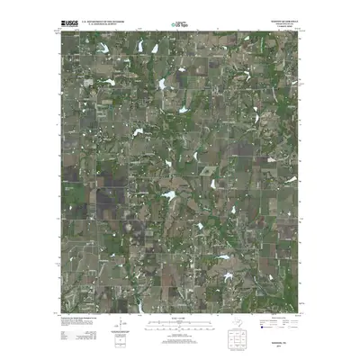
2013 Map of Weston
USGS Topo · Published 2013About this map
Weston serves as a focal point in this portion of Collin County, where the landscape is defined by the headwaters and tributaries of the E Fork Trinity River. The settlement pattern reflects a deeply rooted agricultural history, with small communities like Chambersville, Roland, and Rhea Mills connected by a network of farm-to-market roads and county routes. Family and community heritage is preserved across several burial grounds, including Mugg Cem, Corinth Cem, and Horn Cem, which are scattered throughout the drainage basins of Honey Cr and Haw Br. The presence of small aviation facilities like Bishop's Landing Airport and Tallows Field Airport alongside established watercourses like Wilson Cr suggests a transition in local transport and land use. The map captures the area before significant suburban expansion, showing a rural landscape dominated by creek branches and the winding course of Whites Cr.
Find a feature on this map
121 named features on this map. Tap any name to fly to it.
Don’t see what you’re looking for? This feature index may not catch every label — zoom into the map to look around manually.
Map Details
Editions of this 2013 Weston Map
This is the sole edition of this map. No revisions or reprints were ever made.
Other maps of this area

1929 · Frisco
USGS Topo · 1:62,500

1929 · McKinney
USGS Topo · 1:62,500

1954 · Sherman
USGS Topo · 1:250,000

1958 · Sherman
USGS Topo · 1:250,000

1960 · Frisco
USGS Topo · 1:24,000

1960 · McKinney East
USGS Topo · 1:24,000

1960 · Celina
USGS Topo · 1:24,000
1960 · McKinney West
USGS Topo · 1:24,000

1961 · Gunter
USGS Topo · 1:24,000

1961 · Van Alstyne
USGS Topo · 1:24,000