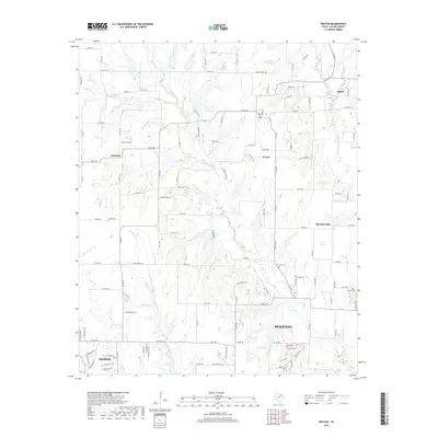
2019 Map of Weston
USGS Topo · Published 2019About this map
Weston and Chambersville anchor this north Texas landscape, where the agricultural past meets the expanding modern footprints of Celina, Anna, Prosper, and northern McKinney. The area is defined by a dense network of watercourses, most notably the E Fork Trinity River and its numerous tributaries like Honey Cr, Stover Cr, and Haw Br. These drainages create a complex pattern of terrain that dictated early settlement and cemetery placements.
Find a feature on this map
117 named features on this map. Tap any name to fly to it.
Don’t see what you’re looking for? This feature index may not catch every label — zoom into the map to look around manually.
Map Details
Editions of this 2019 Weston Map
This is the sole edition of this map. No revisions or reprints were ever made.
Other maps of this area

1929 · Frisco
USGS Topo · 1:62,500

1929 · McKinney
USGS Topo · 1:62,500

1954 · Sherman
USGS Topo · 1:250,000

1958 · Sherman
USGS Topo · 1:250,000

1960 · Frisco
USGS Topo · 1:24,000

1960 · McKinney East
USGS Topo · 1:24,000

1960 · Celina
USGS Topo · 1:24,000
1960 · McKinney West
USGS Topo · 1:24,000

1961 · Gunter
USGS Topo · 1:24,000

1961 · Van Alstyne
USGS Topo · 1:24,000