2022 Map of Weston
USGS Topo · Published 2022About this map
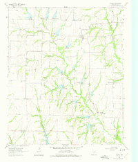
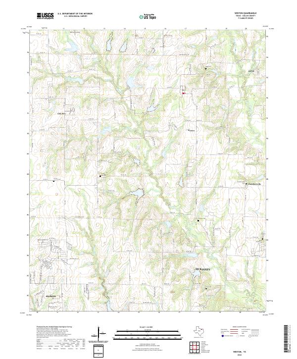
Weston and Chambersville occupy the center of this north Texas landscape, where the headwaters of numerous creeks begin their descent toward the Trinity basin. This survey documents the rural character of northern Collin County before the rapid suburban expansion from the south fully transformed these agricultural lands. The terrain is defined by the winding paths of Honey Cr, Stover Creek, and Haw Branch, which create a complex drainage pattern across the prairie. For those documenting local history, the map preserves a significant network of small family and community burial sites, including the Mugg Cem and Franklin Cem. Notable landmarks such as Bishop's Landing and the E Fork Trinity River reflect the importance of water resources in the local geography, while the outskirts of Celina, Anna, and Prosper indicate the growing footprints of these historically rural communities.
Find a feature on this map
127 named features on this map. Tap any name to fly to it.
Don’t see what you’re looking for? This feature index may not catch every label — zoom into the map to look around manually.
Map Details
Editions of this 2022 Weston Map
This is the sole edition of this map. No revisions or reprints were ever made.