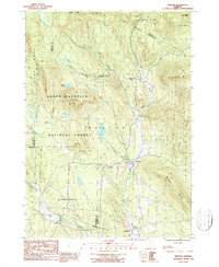
1986 Map of Weston
USGS Topo · Published 1987About this map
Weston and its surrounding mountain terrain are documented here just as the late 20th century preserved the region's classic village structures and high-elevation conservation lands. The West River carves a central valley through the landscape, providing the corridor for the primary settlement at Weston and the secluded Weston Priory to the north. This mid-1980s data reflects a landscape defined by significant public land holdings, including a massive portion of the Green Mountain National Forest and the Okemo State Forest at the northeastern corner. High peaks like Terrible Mountain and Holt Mtn overlook a network of trout streams such as Jenny Coolidge Brook and Utley Brook. Local historians will find the exact locations of several Cem sites and the small community of North Landgrove tucked along the southwestern border.
Find a feature on this map
30 named features on this map. Tap any name to fly to it.
Don’t see what you’re looking for? This feature index may not catch every label — zoom into the map to look around manually.
Map Details
Editions of this 1986 Weston Map
2 editions found
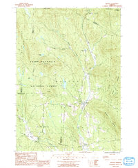
Other maps of this area

1893 · Wallingford
USGS Topo · 1:62,500

1894 · Londonderry
USGS Topo · 1:62,500

1899 · Londonderry
USGS Topo · 1:62,500

1928 · Ludlow
USGS Topo · 1:48,000

1929 · Ludlow
USGS Topo · 1:62,500

1930 · Saxtons River
USGS Topo · 1:48,000

1932 · Ludlow
USGS Topo · 1:62,500

1933 · Saxtons River
USGS Topo · 1:62,500

1950 · Glens Falls
USGS Topo · 1:250,000

1955 · Wallingford
USGS Topo · 1:62,500