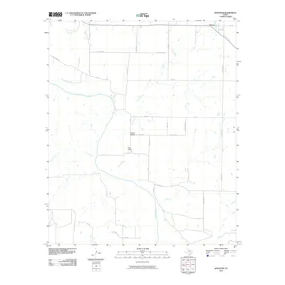
2010 Map of Westover
USGS Topo · Published 2010About this map
The Brazos River meanders through this landscape of the Texas plains, joined by a network of drainage systems including Mule Creek, Aytes Branch, and Bull Creek. The map documents a predominantly rural region of Baylor County, anchored by the small settlement of Westover in the northeast and Round Timber near the center. Family and local history researchers will find the Round Timber Cemetery situated along Round Timber Rd, providing a specific point of interest for genealogical study. The area's infrastructure is defined by a grid of agricultural and farm-to-market roads, such as FM 1285 and FM 2374, which connect these isolated communities. The terrain is characterized by the convergence of several waterways, including Spring Creek and Wagon Creek, highlighting the importance of the river basin in defining the local geography and transportation patterns.
Find a feature on this map
31 named features on this map. Tap any name to fly to it.
Don’t see what you’re looking for? This feature index may not catch every label — zoom into the map to look around manually.
Map Details
Editions of this 2010 Westover Map
This is the sole edition of this map. No revisions or reprints were ever made.
Other maps of this area

1932 · Dundee
USGS Topo · 1:62,500

1954 · Wichita Falls
USGS Topo · 1:250,000

1958 · Wichita Falls
USGS Topo · 1:250,000

1963 · Dundee SW
USGS Topo · 1:24,000

1963 · Megargel
USGS Topo · 1:24,000

1964 · Padgett
USGS Topo · 1:24,000

1966 · Westover SE
USGS Topo · 1:24,000

1966 · Rock Canyon
USGS Topo · 1:24,000

1966 · Westover SW
USGS Topo · 1:24,000

1966 · Seymour East
USGS Topo · 1:24,000