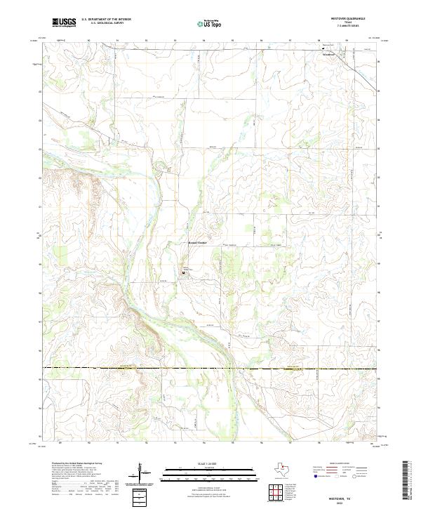
2022 Map of Westover
USGS Topo · Published 2022About this map
The Brazos River carves a winding path across this portion of the Texas interior, defining the lower reaches of the landscape where the Baylor Co and Throckmorton Co lines meet. Settlement centers on the small community of Westover in the northeast and the locality of Round Timber further south. These rural centers are anchored by their respective burial grounds, the Westover Cem and Round Timber Cem, which serve as vital touchstones for genealogists tracing family roots in this corner of Baylor County. The terrain is deeply etched by a network of drainage systems, including Muhle Cr, Deep Cr, and Aytes Br, which flow toward the primary river valley. A web of secondary roads and farm-to-market routes, such as FM 1285 and FM 2374, connects the scattered farmsteads and provides the modern structure for this traditional ranching and agricultural region.
Find a feature on this map
38 named features on this map. Tap any name to fly to it.
Don’t see what you’re looking for? This feature index may not catch every label — zoom into the map to look around manually.
Map Details
Editions of this 2022 Westover Map
This is the sole edition of this map. No revisions or reprints were ever made.
Other maps of this area

1932 · Dundee
USGS Topo · 1:62,500

1954 · Wichita Falls
USGS Topo · 1:250,000

1958 · Wichita Falls
USGS Topo · 1:250,000

1963 · Dundee SW
USGS Topo · 1:24,000

1963 · Megargel
USGS Topo · 1:24,000

1964 · Padgett
USGS Topo · 1:24,000

1966 · Westover SE
USGS Topo · 1:24,000

1966 · Rock Canyon
USGS Topo · 1:24,000

1966 · Westover SW
USGS Topo · 1:24,000

1966 · Seymour East
USGS Topo · 1:24,000