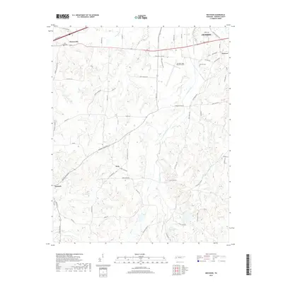
2019 Map of Westover
USGS Topo · Published 2019About this map
Mc Kellar-Sipes Regional Airport and the sprawling southwestern reaches of Jackson dominate this Madison County landscape. The map reveals a transition from the urban edge near Westover to the rural expanses of western Tennessee, where a network of family-named roads like Valentine Rd and Harvey Johnson Rd connect small settlements. The area is defined by the winding paths of Johnson Creek and Big Black Cr, creating a complex drainage system that supported the historic communities of Denmark, Huntersville, and Neely. For genealogists and local historians, the placement of Oak Grove Cem and Lane Chapel Cem provides essential coordinate points for family research in this part of the county. The cartography clearly illustrates how modern infrastructure, such as the airport and secondary highways like Denmark Jackson Rd, has been superimposed over the traditional agricultural grid of the region.
Find a feature on this map
67 named features on this map. Tap any name to fly to it.
Don’t see what you’re looking for? This feature index may not catch every label — zoom into the map to look around manually.
Map Details
Editions of this 2019 Westover Map
This is the sole edition of this map. No revisions or reprints were ever made.
Other maps of this area

1950 · Jackson South
USGS Topo · 1:24,000

1950 · Jackson North
USGS Topo · 1:24,000

1951 · Jackson North
USGS Topo · 1:24,000

1956 · Blytheville
USGS Topo · 1:250,000

1959 · Blytheville
USGS Topo · 1:250,000

1959 · Bells
USGS Topo · 1:24,000

1959 · Westover
USGS Topo · 1:24,000

1959 · Denmark
USGS Topo · 1:24,000

1959 · Adair
USGS Topo · 1:24,000

1961 · Medon
USGS Topo · 1:24,000