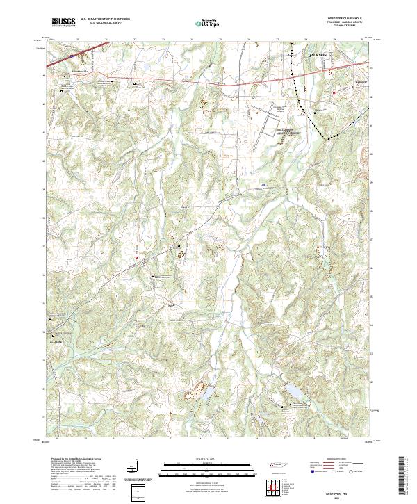
2022 Map of Westover
USGS Topo · Published 2022About this map
Huntersville and the western outskirts of Jackson define the northern corridor of this Madison County landscape. This region is characterized by a high density of rural spiritual and burial sites, including Lane Chapel Cem and Ararat Baptist Church Cem. The terrain is etched by a complex drainage system where Johnson Creek and Cub Cr navigate the undulating topography. In the southern reaches, the settlement of Denmark serves as a local anchor near the Denmark Presbyterian Cem. This map records a landscape where modern infrastructure, such as the McKellar-Sipes Regional Airport, exists alongside deeply established family and community landmarks like Taylor Cem and the Bobbitt Memorial Garden, reflecting the persistent rural character of the area just beyond the growing city limits.
Find a feature on this map
80 named features on this map. Tap any name to fly to it.
Don’t see what you’re looking for? This feature index may not catch every label — zoom into the map to look around manually.
Map Details
Editions of this 2022 Westover Map
This is the sole edition of this map. No revisions or reprints were ever made.
Other maps of this area

1950 · Jackson South
USGS Topo · 1:24,000

1950 · Jackson North
USGS Topo · 1:24,000

1951 · Jackson North
USGS Topo · 1:24,000

1956 · Blytheville
USGS Topo · 1:250,000

1959 · Blytheville
USGS Topo · 1:250,000

1959 · Bells
USGS Topo · 1:24,000

1959 · Westover
USGS Topo · 1:24,000

1959 · Denmark
USGS Topo · 1:24,000

1959 · Adair
USGS Topo · 1:24,000

1961 · Medon
USGS Topo · 1:24,000