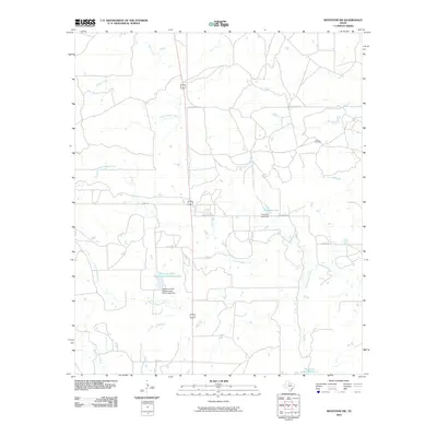
2010 Map of Westover SW
USGS Topo · Published 2010About this map
The Texas A and M Experimental Ranch Lake and its associated dam stand as central features in this rural Throckmorton County landscape. The region is defined by a sparse but organized network of ranching and resource extraction roads, including Spade Ranch Rd and McWhorter Rd. Water management and energy production are the primary economic signatures visible on the land, evidenced by the Travis Oil Field and numerous named water bodies like Timmons Lake and Patterson Lake Number 2. The terrain is drained by an intricate system of creeks, with Wagon Creek in the north and the converging branches of North Boggy Creek and South Boggy Creek toward the south. This survey illustrates the modern ranching infrastructure of North Texas, where large-scale experimental agricultural tracts and oil interests dictate the local geography.
Find a feature on this map
19 named features on this map. Tap any name to fly to it.
Don’t see what you’re looking for? This feature index may not catch every label — zoom into the map to look around manually.
Map Details
Editions of this 2010 Westover SW Map
This is the sole edition of this map. No revisions or reprints were ever made.
Other maps of this area

1954 · Wichita Falls
USGS Topo · 1:250,000

1958 · Wichita Falls
USGS Topo · 1:250,000

1962 · Antelope Creek SE
USGS Topo · 1:24,000

1962 · Antelope Creek NE
USGS Topo · 1:24,000

1965 · Throckmorton NE
USGS Topo · 1:24,000

1966 · Westover SE
USGS Topo · 1:24,000

1966 · Rock Canyon
USGS Topo · 1:24,000

1966 · Westover SW
USGS Topo · 1:24,000

1966 · Tonk Creek
USGS Topo · 1:24,000
1966 · Throckmorton
USGS Topo · 1:24,000