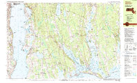
1985 Map of Westport
USGS Topo · Published 1985About this map
The coastal borderlands of Massachusetts and Rhode Island meet in this 1985 survey, defined by the intricate finger-like estuaries of the Westport River and the broad Sakonnet River. The landscape is a patchwork of small agricultural crossroads and maritime villages, including the tightly clustered Westport Point and the inland hub of Adamsville. This era shows a community balanced between its rural roots and recreational growth, as seen in the extensive Horseneck Beach State Reservation and the Westport Yacht Club nestled along the shoreline.
Find a feature on this map
133 named features on this map. Tap any name to fly to it.
Don’t see what you’re looking for? This feature index may not catch every label — zoom into the map to look around manually.
Map Details
Editions of this 1985 Westport Map
This is the sole edition of this map. No revisions or reprints were ever made.
Other maps of this area

1885 · New Bedford
USGS Topo · 1:62,500

1885 · Sakonnet
USGS Topo · 1:62,500

1888 · New Bedford
USGS Topo · 1:62,500

1888 · Fall River
USGS Topo · 1:62,500

1888 · Sakonnet
USGS Topo · 1:62,500

1889 · Newport
USGS Topo · 1:62,500

1890 · Narragansett Bay
USGS Topo · 1:62,500

1892 · Narragansett Bay
USGS Topo · 1:62,500

1893 · Sakonnet
USGS Topo · 1:62,500

1893 · Fall River
USGS Topo · 1:62,500