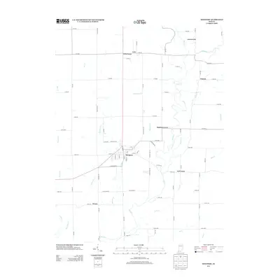
2013 Map of Westport
USGS Topo · Published 2013About this map
Westport serves as the primary hub of this rural Decatur County landscape, situated at the confluence of local routes like W Main St and S Lincoln St. The surrounding countryside is defined by a dense network of watercourses, including the winding Sand Cr and its tributaries such as Wyaloosing Cr and Millstone Cr. Small outlying hamlets and named intersections illustrate the settlement patterns of the early twenty-first century, with places like Gaynorsville, Pinhook, and Letts Corner anchoring the agricultural grid. The map reveals a land structured by county roads, from Co RD-600 to Co RD-1100, which connect these dispersed communities. Researchers will find the detailed naming of small waterways like Rodney Br and Ice Cr particularly useful for pinpointing specific family tracts or historical drainage changes within the township.
Find a feature on this map
73 named features on this map. Tap any name to fly to it.
Don’t see what you’re looking for? This feature index may not catch every label — zoom into the map to look around manually.
Map Details
Editions of this 2013 Westport Map
This is the sole edition of this map. No revisions or reprints were ever made.
Other maps of this area

1942 · Columbus
USGS Topo · 1:125,000

1953 · Cincinnati
USGS Topo · 1:250,000

1957 · Cincinnati
USGS Topo · 1:250,000

1957 · Butlerville
USGS Topo · 1:24,000

1957 · North Vernon
USGS Topo · 1:24,000

1958 · Greensburg
USGS Topo · 1:24,000

1958 · Millhousen
USGS Topo · 1:24,000

1958 · Westport
USGS Topo · 1:24,000

1958 · Forest Hill
USGS Topo · 1:24,000

1958 · Hartsville
USGS Topo · 1:24,000