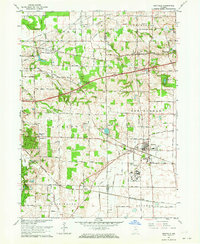
1962 Map of Westville
USGS Topo · Published 1964About this map
The intersection of several major rail lines defines the character of this northern Indiana landscape, as the Monon Railroad, Wabash Railroad, and New York Central converge near the town of Westville. This 1962 revision highlights the significant institutional footprint in the area, dominated by the sprawling grounds of the Beatty Memorial Hospital and the nearby State Prison Farm. These large facilities, along with the Sewage Disposal plant and Water Tank, reflect the specialized mid-century development of this portion of La Porte and Porter counties.
Find a feature on this map
73 named features on this map. Tap any name to fly to it.
Don’t see what you’re looking for? This feature index may not catch every label — zoom into the map to look around manually.
Map Details
Editions of this 1962 Westville Map
This is the sole edition of this map. No revisions or reprints were ever made.
Other maps of this area

1934 · Porter
USGS Topo · 1:48,000

1940 · Porter
USGS Topo · 1:62,500

1953 · Wanatah
USGS Topo · 1:24,000

1953 · Westville
USGS Topo · 1:24,000

1953 · Valparaiso
USGS Topo · 1:24,000

1953 · Chesterton
USGS Topo · 1:24,000

1953 · Dune Acres
USGS Topo · 1:24,000

1953 · Michigan City West
USGS Topo · 1:24,000

1953 · Chicago
USGS Topo · 1:250,000

1957 · Chicago
USGS Topo · 1:250,000