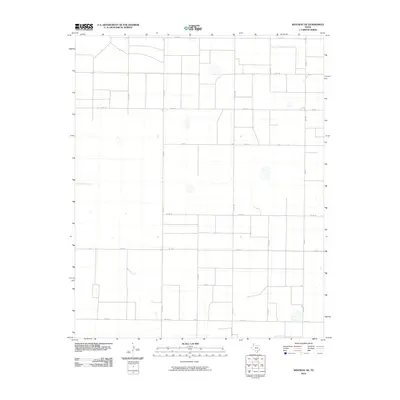
2010 Map of Westway NE
USGS Topo · Published 2010About this map
Agricultural grid patterns define this section of Deaf Smith County, where the landscape is etched into a series of uniform squares by a robust network of county roads. Primary north-south corridors like Co Rd MM and Co Rd M provide the backbone for rural transit, intersecting with east-west routes such as Co Rd 17 and Co Rd 11. This 2010 survey by the U.S. Geological Survey illustrates the methodical organization of the Texas Panhandle, where farm-to-market infrastructure is essential for the region's ranching and farming operations.
Find a feature on this map
17 named features on this map. Tap any name to fly to it.
Don’t see what you’re looking for? This feature index may not catch every label — zoom into the map to look around manually.
Map Details
Editions of this 2010 Westway NE Map
This is the sole edition of this map. No revisions or reprints were ever made.
Other maps of this area

1954 · Tucumcari
USGS Topo · 1:250,000

1954 · Clovis
USGS Topo · 1:250,000

1958 · Clovis
USGS Topo · 1:250,000

1958 · Tucumcari
USGS Topo · 1:250,000

1966 · Overstreet Lake
USGS Topo · 1:24,000

1966 · Simms
USGS Topo · 1:24,000

1966 · Ford
USGS Topo · 1:24,000

1970 · Chalk Hill
USGS Topo · 1:24,000

1970 · Hereford
USGS Topo · 1:24,000

1971 · Westway
USGS Topo · 1:24,000