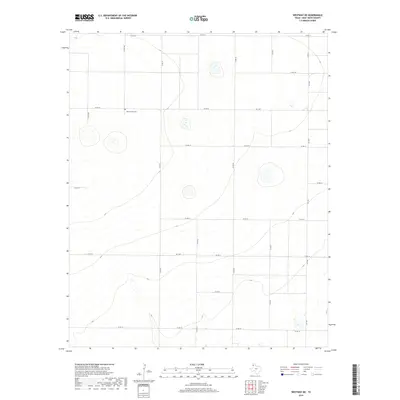
2019 Map of Westway NE
USGS Topo · Published 2019About this map
The Old La Plata Cem stands as a significant historical marker on this high plains landscape of Deaf Smith County, suggesting the location of a former community center in this rural ranching and farming district. Modernized infrastructure defines the current era, with FM 1057 providing north-south transit across the eastern portion of the grid. The terrain is organized by an extensive network of secondary roads, including Co Rd 17 and Co Rd 10, which follow the cardinal directions and carve the Panhandle landscape into large agricultural tracts. The map reveals the subtle topography of the region, where seasonal water features and depressions are scattered between the surveyed county lines, illustrating how local land use remains tied to the underlying drainage patterns of the Texas plains.
Find a feature on this map
20 named features on this map. Tap any name to fly to it.
Don’t see what you’re looking for? This feature index may not catch every label — zoom into the map to look around manually.
Map Details
Editions of this 2019 Westway NE Map
This is the sole edition of this map. No revisions or reprints were ever made.
Other maps of this area

1954 · Tucumcari
USGS Topo · 1:250,000

1954 · Clovis
USGS Topo · 1:250,000

1958 · Clovis
USGS Topo · 1:250,000

1958 · Tucumcari
USGS Topo · 1:250,000

1966 · Overstreet Lake
USGS Topo · 1:24,000

1966 · Simms
USGS Topo · 1:24,000

1966 · Ford
USGS Topo · 1:24,000

1970 · Chalk Hill
USGS Topo · 1:24,000

1970 · Hereford
USGS Topo · 1:24,000

1971 · Westway
USGS Topo · 1:24,000