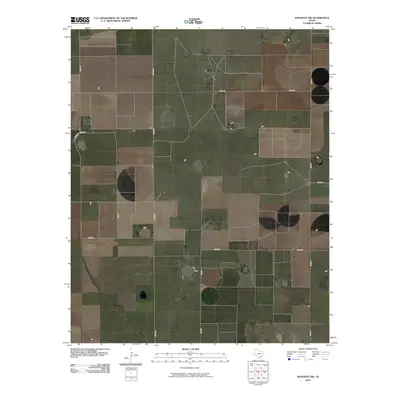
2010 Map of Westway NW
USGS Topo · Published 2010About this map
Deaf Smith County's high plains terrain is defined by a rigid grid of agricultural infrastructure and seasonal water features in this 2010 survey. The landscape is organized by a systematic network of county routes, including Co Rd PP and Co Rd OO, which segment the territory into expansive rectangular parcels typical of the Texas Panhandle. This layout facilitates large-scale ranching and farming operations, where local transport depends on long straightaways like Co Rd N and Co Rd P. Scattered across these sections are several small, intermittent water bodies and depressions that serve as vital drainage or livestock watering points in an otherwise arid environment. The map captures the intersection of thoroughfares such as Co Rd 12 and Co Rd 15, illustrating the sparse but deliberate human imprint on this wide-open prairie land.
Find a feature on this map
9 named features on this map. Tap any name to fly to it.
Don’t see what you’re looking for? This feature index may not catch every label — zoom into the map to look around manually.
Map Details
Editions of this 2010 Westway NW Map
This is the sole edition of this map. No revisions or reprints were ever made.
Other maps of this area

1954 · Tucumcari
USGS Topo · 1:250,000

1954 · Clovis
USGS Topo · 1:250,000

1958 · Clovis
USGS Topo · 1:250,000

1958 · Tucumcari
USGS Topo · 1:250,000

1966 · Overstreet Lake
USGS Topo · 1:24,000

1966 · Simms
USGS Topo · 1:24,000

1966 · Norton Lake
USGS Topo · 1:24,000

1970 · Chalk Hill
USGS Topo · 1:24,000

1971 · Westway
USGS Topo · 1:24,000

1971 · Bootleg
USGS Topo · 1:24,000