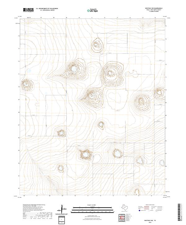
2022 Map of Westway NW
USGS Topo · Published 2022About this map
Playa lakes and undulating plains define the topography of Deaf Smith County in this recent geographic study. The landscape is structured by a methodical grid of rural thoroughfares, including Co Rd Pp, Co Rd Oo, and Co Rd N, which delineate the expansive agricultural parcels characteristic of the Texas Panhandle. Natural depressions across the terrain collect intermittent surface water, creating small, distinct basins that contrast with the surrounding high-elevation contours. This map illustrates the modern spatial organization of a region where the vast open range has been meticulously divided into a network of county roads. These transit lines, such as Co Rd 16 and Co Rd 12, serve as the primary infrastructure for the remote farmsteads and ranching operations that have shaped the local economy for generations.
Find a feature on this map
9 named features on this map. Tap any name to fly to it.
Don’t see what you’re looking for? This feature index may not catch every label — zoom into the map to look around manually.
Map Details
Editions of this 2022 Westway NW Map
This is the sole edition of this map. No revisions or reprints were ever made.
Other maps of this area

1954 · Tucumcari
USGS Topo · 1:250,000

1954 · Clovis
USGS Topo · 1:250,000

1958 · Clovis
USGS Topo · 1:250,000

1958 · Tucumcari
USGS Topo · 1:250,000

1966 · Overstreet Lake
USGS Topo · 1:24,000

1966 · Simms
USGS Topo · 1:24,000

1966 · Norton Lake
USGS Topo · 1:24,000

1970 · Chalk Hill
USGS Topo · 1:24,000

1971 · Westway
USGS Topo · 1:24,000

1971 · Bootleg
USGS Topo · 1:24,000