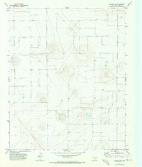
1971 Map of Westway NW
USGS Topo · Published 1973About this map
Agricultural water management dominates this high plains landscape of Deaf Smith County during the early 1970s. The survey reveals a terrain defined by subtle topographic depressions and an extensive network of groundwater extraction points, marked simply as Well or Wells across the quadrangle. These features indicate the vital role of irrigation and livestock watering in this region of the Texas Panhandle, where surface water is scarce and reliance on the underlying aquifer is absolute. The map's contour lines illustrate the undulating surface of the Llano Estacado, providing a precise record of the land before modern center-pivot irrigation systems further transformed the local ranching and farming practices.
Find a feature on this map
2 named features on this map. Tap any name to fly to it.
Don’t see what you’re looking for? This feature index may not catch every label — zoom into the map to look around manually.
Map Details
Editions of this 1971 Westway NW Map
This is the sole edition of this map. No revisions or reprints were ever made.
Other maps of this area

1954 · Tucumcari
USGS Topo · 1:250,000

1954 · Clovis
USGS Topo · 1:250,000

1958 · Clovis
USGS Topo · 1:250,000

1958 · Tucumcari
USGS Topo · 1:250,000

1966 · Overstreet Lake
USGS Topo · 1:24,000

1966 · Simms
USGS Topo · 1:24,000

1966 · Norton Lake
USGS Topo · 1:24,000

1970 · Chalk Hill
USGS Topo · 1:24,000

1971 · Westway
USGS Topo · 1:24,000

1971 · Bootleg
USGS Topo · 1:24,000