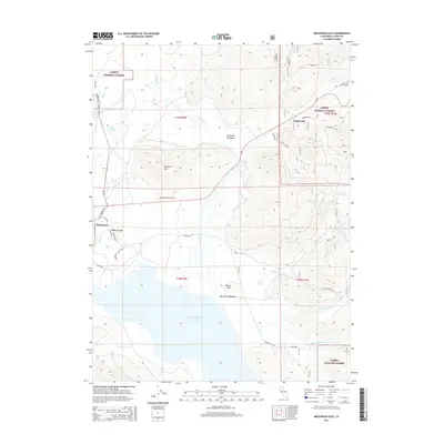
2015 Map of Westwood East
USGS Topo · Published 2015About this map
Lassen National Forest terrain dominates this 2015 study of the high country, where the vast Mountain Meadows Reservoir collects the drainages of Mountain Meadows Cr and Cottonwood Cr. The settlement of Westwood and the adjacent Pine Town sit near the western edge of the sheet, connected by local roads like Firland Dr and Parkwood Dr. The landscape is a mix of volcanic peaks and high-altitude basins, including Goodrich Mtn and Round Mtn, which rise above the expansive Mountain Meadows. Geographers and local historians can trace the intricate network of forest service roads, such as 29n46, that navigate the timbered slopes around McKenzie Meadows. The inclusion of the Westwood Cemetery north of the main town provides a specific point of interest for genealogical research in this Lassen County corridor.
Find a feature on this map
53 named features on this map. Tap any name to fly to it.
Don’t see what you’re looking for? This feature index may not catch every label — zoom into the map to look around manually.
Map Details
Editions of this 2015 Westwood East Map
This is the sole edition of this map. No revisions or reprints were ever made.
Other maps of this area

1886 · Honey Lake
USGS Topo · 1:250,000

1886 · Lassen Peak
USGS Topo · 1:250,000

1891 · Honey Lake
USGS Topo · 1:250,000

1892 · Lassen Peak
USGS Topo · 1:250,000

1893 · Honey Lake
USGS Topo · 1:250,000

1894 · Lassen Peak
USGS Topo · 1:250,000

1950 · Greenville
USGS Topo · 1:62,500

1955 · Westwood
USGS Topo · 1:62,500

1955 · Almanor
USGS Topo · 1:62,500

1955 · Westwood
USGS Topo · 1:250,000