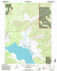
1995 Map of Westwood East
USGS Topo · Published 1998About this map
Mountain Meadows Reservoir dominates the southern landscape of this 1995 revision, its waters contained by a spillway at 5,043 feet. The timber and ranching character of Lassen National Forest is evident in the transition from the settlement of Westwood and the adjacent Pine Town to the outlying 101 Ranch and Home Ranch. The topography is defined by significant elevations like Goodrich Mountain and Round Mtn, while the drainage system of Goodrich Creek and McKenzie Creek feeds into the expansive McKenzie Meadows.
Find a feature on this map
31 named features on this map. Tap any name to fly to it.
Don’t see what you’re looking for? This feature index may not catch every label — zoom into the map to look around manually.
Map Details
Editions of this 1995 Westwood East Map
This is the sole edition of this map. No revisions or reprints were ever made.
Other maps of this area

1886 · Honey Lake
USGS Topo · 1:250,000

1886 · Lassen Peak
USGS Topo · 1:250,000

1891 · Honey Lake
USGS Topo · 1:250,000

1892 · Lassen Peak
USGS Topo · 1:250,000

1893 · Honey Lake
USGS Topo · 1:250,000

1894 · Lassen Peak
USGS Topo · 1:250,000

1950 · Greenville
USGS Topo · 1:62,500

1955 · Westwood
USGS Topo · 1:62,500

1955 · Almanor
USGS Topo · 1:62,500

1955 · Westwood
USGS Topo · 1:250,000