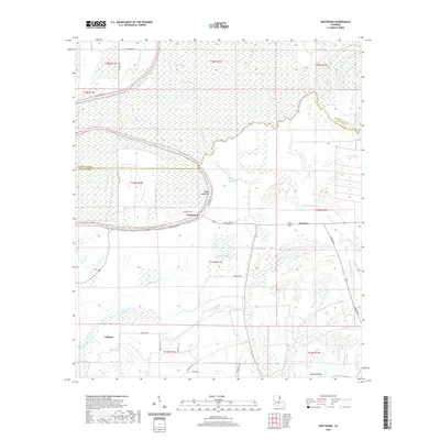
2020 Map of Westwood
USGS Topo · Published 2020About this map
The Tensas River meanders through this low-lying landscape, defining the boundary between Madison and Tensas Parishes. This wetland-rich environment is characterized by a complex network of waterways, including Steep Bank Bayou, Cypress Bayou, and the winding Wildhorse Bayou. Small settlements like Westwood and Dearborn are situated along the elevated grounds of Ridge Lake Bend, while Wildcat lies further south.
Find a feature on this map
36 named features on this map. Tap any name to fly to it.
Don’t see what you’re looking for? This feature index may not catch every label — zoom into the map to look around manually.
Map Details
Editions of this 2020 Westwood Map
This is the sole edition of this map. No revisions or reprints were ever made.
Other maps of this area

1935 · Waverly
USGS Topo · 1:62,500

1935 · Shackleford Lake
USGS Topo · 1:62,500

1939 · Talla Bena
USGS Topo · 1:62,500

1955 · Jackson
USGS Topo · 1:250,000

1958 · Shackleford Lake
USGS Topo · 1:62,500

1961 · Jackson
USGS Topo · 1:250,000

1961 · Waverly
USGS Topo · 1:62,500

1962 · Jackson
USGS Topo · 1:250,000
1963 · Somerset
USGS Topo · 1:24,000
1963 · Fortune Fork
USGS Topo · 1:24,000