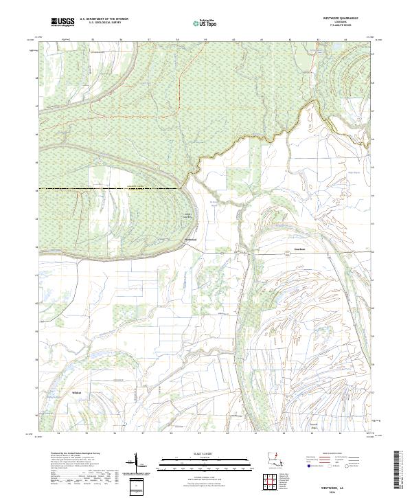
2024 Map of Westwood
USGS Topo · Published 2024About this map
Tensas River National Wildlife Refuge dominates the landscape of this Madison and Tensas Parish borderlands, where the sinuous Tensas River meanders through bottomland forests and oxbow remnants. The terrain is a complex network of hydrologic features, including Wildhorse Bayou, Cypress Bayou, and Du Rosset Bayou, reflecting the ancient alluvial patterns of the Mississippi Delta. Small settlements such as Westwood and Dearborn are situated along these waterways and rural roads like Parish Rd 103.
Find a feature on this map
39 named features on this map. Tap any name to fly to it.
Don’t see what you’re looking for? This feature index may not catch every label — zoom into the map to look around manually.
Map Details
Editions of this 2024 Westwood Map
This is the sole edition of this map. No revisions or reprints were ever made.
Other maps of this area

1935 · Waverly
USGS Topo · 1:62,500

1935 · Shackleford Lake
USGS Topo · 1:62,500

1939 · Talla Bena
USGS Topo · 1:62,500

1955 · Jackson
USGS Topo · 1:250,000

1958 · Shackleford Lake
USGS Topo · 1:62,500

1961 · Jackson
USGS Topo · 1:250,000

1961 · Waverly
USGS Topo · 1:62,500

1962 · Jackson
USGS Topo · 1:250,000
1963 · Somerset
USGS Topo · 1:24,000
1963 · Fortune Fork
USGS Topo · 1:24,000