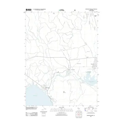
2012 Map of Westwood West
USGS Topo · Published 2012About this map
Lake Almanor and the northern reaches of the Mountain Meadows Reservoir define this transition from the water's edge to the timbered heights of the Sierra Nevada. The settlement of Westwood anchors the eastern edge of the map, supported by the nearby Westwood Airport and infrastructure like the Westwood Dump. To the southwest, residential clusters such as Hamilton Branch and Lassen View sit along the shoreline, connected by local roads like Big Springs Rd and Peninsula Dr. This 2012 survey illustrates the importance of water management and local springs, including Big Springs, Walker Spring, and Schumacher Spring, which feed the drainages of Hamilton Br and Dry Cr. The presence of Clear Creek Junction and the community of Clear Creek highlight the intersection of transportation and early 21st-century rural development in this corner of Lassen County.
Find a feature on this map
64 named features on this map. Tap any name to fly to it.
Don’t see what you’re looking for? This feature index may not catch every label — zoom into the map to look around manually.
Map Details
Editions of this 2012 Westwood West Map
This is the sole edition of this map. No revisions or reprints were ever made.
Other maps of this area

1886 · Honey Lake
USGS Topo · 1:250,000

1886 · Lassen Peak
USGS Topo · 1:250,000

1891 · Honey Lake
USGS Topo · 1:250,000

1892 · Lassen Peak
USGS Topo · 1:250,000

1893 · Honey Lake
USGS Topo · 1:250,000

1894 · Lassen Peak
USGS Topo · 1:250,000

1950 · Greenville
USGS Topo · 1:62,500

1955 · Westwood
USGS Topo · 1:62,500

1955 · Almanor
USGS Topo · 1:62,500

1955 · Westwood
USGS Topo · 1:250,000