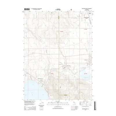
2015 Map of Westwood West
USGS Topo · Published 2015About this map
Westwood and the northern reaches of Lake Almanor anchor this geography in the southern Cascades, where the Lassen and Plumas county lines intersect. The settlement at Hamilton Branch is detailed alongside residential street networks like Peninsula Drive and Hillcrest Drive, reflecting the area's development around the water. To the east, the Mountain Meadows Reservoir and its associated wetlands contrast with the rising timberland of the Lassen National Forest, which covers much of the northern half of the map. Transport and utility infrastructure is evident through the presence of an unnamed railroad segment labeled Un Rd-RR and the Powerline S corridor. High points like Jennie Mountain and Little Dyer Mountain overlook a landscape carved by Robbers Creek and Clear Creek, where spring-fed systems like Big Springs and Walker Spring continue to define the local hydrology.
Find a feature on this map
65 named features on this map. Tap any name to fly to it.
Don’t see what you’re looking for? This feature index may not catch every label — zoom into the map to look around manually.
Map Details
Editions of this 2015 Westwood West Map
This is the sole edition of this map. No revisions or reprints were ever made.
Other maps of this area

1886 · Honey Lake
USGS Topo · 1:250,000

1886 · Lassen Peak
USGS Topo · 1:250,000

1891 · Honey Lake
USGS Topo · 1:250,000

1892 · Lassen Peak
USGS Topo · 1:250,000

1893 · Honey Lake
USGS Topo · 1:250,000

1894 · Lassen Peak
USGS Topo · 1:250,000

1950 · Greenville
USGS Topo · 1:62,500

1955 · Westwood
USGS Topo · 1:62,500

1955 · Almanor
USGS Topo · 1:62,500

1955 · Westwood
USGS Topo · 1:250,000