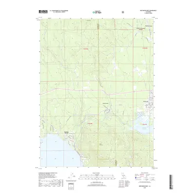
2018 Map of Westwood West
USGS Topo · Published 2018About this map
The rugged boundary between Lassen and Plumas counties defines this landscape, where the southern extent of Lassen National Forest meets the developed northern shores of Lake Almanor. The settlement of Westwood serves as a primary hub, organized by a residential grid of streets like Birch St and Elm St, while the community of Hamilton Branch sits at the confluence of its namesake waterway and the lake. To the east, the Mountain Meadows Reservoir dominates the lowlands, fed by Robbers Cr and Hamilton Br. The terrain is marked by significant vertical relief, rising from the waters to landmarks such as Little Dyer Mtn and Brush Hill. A network of springs, including Tamarack Springs and Walker Spring, suggests a landscape rich in groundwater, supporting the forestry and recreational land use patterns evident in the modern road network.
Find a feature on this map
61 named features on this map. Tap any name to fly to it.
Don’t see what you’re looking for? This feature index may not catch every label — zoom into the map to look around manually.
Map Details
Editions of this 2018 Westwood West Map
This is the sole edition of this map. No revisions or reprints were ever made.
Other maps of this area

1886 · Honey Lake
USGS Topo · 1:250,000

1886 · Lassen Peak
USGS Topo · 1:250,000

1891 · Honey Lake
USGS Topo · 1:250,000

1892 · Lassen Peak
USGS Topo · 1:250,000

1893 · Honey Lake
USGS Topo · 1:250,000

1894 · Lassen Peak
USGS Topo · 1:250,000

1950 · Greenville
USGS Topo · 1:62,500

1955 · Westwood
USGS Topo · 1:62,500

1955 · Almanor
USGS Topo · 1:62,500

1955 · Westwood
USGS Topo · 1:250,000