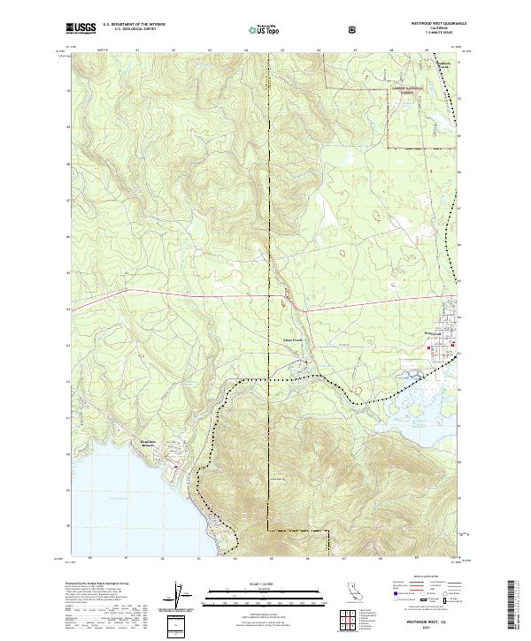
2021 Map of Westwood West
USGS Topo · Published 2021About this map
Westwood serves as the primary hub in this mountain landscape, characterized by its grid of residential streets like Elm St and Fir St near the eastern edge of the Lassen National Forest. The map documents a significant intersection of water management and topography, where the shoreline of Lake Almanor meets the community at Hamilton Branch. This area, situated along the Plumas and Lassen County line, highlights the late 20th-century development patterns of recreational and mountain communities.
Find a feature on this map
62 named features on this map. Tap any name to fly to it.
Don’t see what you’re looking for? This feature index may not catch every label — zoom into the map to look around manually.
Map Details
Editions of this 2021 Westwood West Map
This is the sole edition of this map. No revisions or reprints were ever made.
Other maps of this area

1886 · Honey Lake
USGS Topo · 1:250,000

1886 · Lassen Peak
USGS Topo · 1:250,000

1891 · Honey Lake
USGS Topo · 1:250,000

1892 · Lassen Peak
USGS Topo · 1:250,000

1893 · Honey Lake
USGS Topo · 1:250,000

1894 · Lassen Peak
USGS Topo · 1:250,000

1950 · Greenville
USGS Topo · 1:62,500

1955 · Westwood
USGS Topo · 1:62,500

1955 · Almanor
USGS Topo · 1:62,500

1955 · Westwood
USGS Topo · 1:250,000