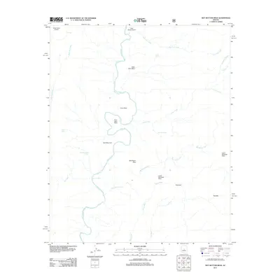
2011 Map of Wet Bottom Mesa
USGS Topo · Published 2011About this map
The Verde River carves a winding path through this portion of Yavapai County, defining the central drainage system and creating distinctive geological formations like Mule Shoe Bend. This landscape is characterized by its significant mesas and high plateaus, including Petes Cabin Mesa, Canoe Mesa, and the namesake Wet Bottom Mesa. These flat-topped features are separated by a network of seasonal drainages such as Goat Camp Creek and Spring Wash, which feed back toward the river valley.
Find a feature on this map
27 named features on this map. Tap any name to fly to it.
Don’t see what you’re looking for? This feature index may not catch every label — zoom into the map to look around manually.
Map Details
Editions of this 2011 Wet Bottom Mesa Map
This is the sole edition of this map. No revisions or reprints were ever made.
Other maps of this area

1887 · Verde
USGS Topo · 1:250,000

1892 · Verde
USGS Topo · 1:250,000

1929 · Turret Peak
USGS Topo · 1:125,000

1933 · Turret Peak
USGS Topo · 1:125,000

1954 · Holbrook
USGS Topo · 1:250,000

1957 · Holbrook
USGS Topo · 1:250,000

1958 · Holbrook
USGS Topo · 1:250,000

1960 · Holbrook
USGS Topo · 1:250,000
1967 · Chalk Mountain
USGS Topo · 1:24,000
1967 · Tule Mesa
USGS Topo · 1:24,000