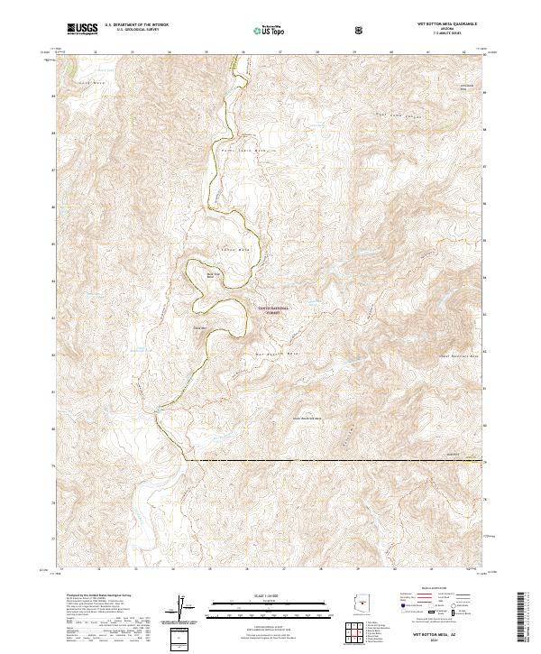
2021 Map of Wet Bottom Mesa
USGS Topo · Published 2021About this map
The Verde Wild and Scenic River carves a dramatic path through this central Arizona landscape, located within the protected bounds of the Tonto National Forest. The waterway creates a sharp loop at Mule Shoe Bend as it flows between massive plateau formations including Petes Cabin Mesa and Canoe Mesa. This 2021 survey details the complex network of high desert water sources such as Marie Spring, Rock Tank Spring, and Peach Tank, which have historically been critical for land use in this arid environment.
Find a feature on this map
35 named features on this map. Tap any name to fly to it.
Don’t see what you’re looking for? This feature index may not catch every label — zoom into the map to look around manually.
Map Details
Editions of this 2021 Wet Bottom Mesa Map
This is the sole edition of this map. No revisions or reprints were ever made.
Other maps of this area

1887 · Verde
USGS Topo · 1:250,000

1892 · Verde
USGS Topo · 1:250,000

1929 · Turret Peak
USGS Topo · 1:125,000

1933 · Turret Peak
USGS Topo · 1:125,000

1954 · Holbrook
USGS Topo · 1:250,000

1957 · Holbrook
USGS Topo · 1:250,000

1958 · Holbrook
USGS Topo · 1:250,000

1960 · Holbrook
USGS Topo · 1:250,000
1967 · Chalk Mountain
USGS Topo · 1:24,000
1967 · Tule Mesa
USGS Topo · 1:24,000