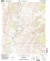
2004 Map of Wet Bottom Mesa
USGS Topo · Published 2007About this map
The Verde River carves a dramatic, winding path through this central Arizona landscape, forming significant topographical features like Mule Shoe Bend and passing through Red Creek Rapids. This 2004 revision of earlier 1960s surveys captures a transition point between the Mazatzal Wilderness and the broader Tonto National Forest, where the terrain rises sharply from the riverbanks to elevated plateaus like Wet Bottom Mesa and Canoe Mesa.
Find a feature on this map
32 named features on this map. Tap any name to fly to it.
Don’t see what you’re looking for? This feature index may not catch every label — zoom into the map to look around manually.
Map Details
Editions of this 2004 Wet Bottom Mesa Map
This is the sole edition of this map. No revisions or reprints were ever made.
Other maps of this area

1887 · Verde
USGS Topo · 1:250,000

1892 · Verde
USGS Topo · 1:250,000

1929 · Turret Peak
USGS Topo · 1:125,000

1933 · Turret Peak
USGS Topo · 1:125,000

1954 · Holbrook
USGS Topo · 1:250,000

1957 · Holbrook
USGS Topo · 1:250,000

1958 · Holbrook
USGS Topo · 1:250,000

1960 · Holbrook
USGS Topo · 1:250,000
1967 · Chalk Mountain
USGS Topo · 1:24,000
1967 · Tule Mesa
USGS Topo · 1:24,000