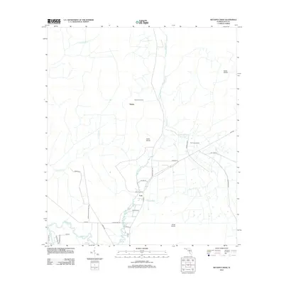
2012 Map of Wetappo Creek
USGS Topo · Published 2012About this map
Wetappo Creek meanders through the lowlands of Gulf County, defining a landscape shaped by water and timber interests. The small settlements of Majette and Early anchor a network of rural roads such as Roberts Rd and Jarrott Daniel Rd, which connect remote homesteads and localized infrastructure. This 2012 survey illustrates the transition between dry upland forests and the intricate wetland systems of the Jersey Islands and Brush Islands. The presence of the Wetappo Side Camp and Fico Farms Airport suggests a dual-use landscape where traditional backcountry camps exist alongside specialized private aviation strips. Genealogists and local historians can trace family-named routes like Buddy Flore Rd and Luke Ford Rd, which provide evidence of the long-standing community ties in this corner of the Florida Panhandle.
Find a feature on this map
31 named features on this map. Tap any name to fly to it.
Don’t see what you’re looking for? This feature index may not catch every label — zoom into the map to look around manually.
Map Details
Editions of this 2012 Wetappo Creek Map
This is the sole edition of this map. No revisions or reprints were ever made.
Other maps of this area

1943 · Overstreet
USGS Topo · 1:31,680

1944 · Beacon Hill
USGS Topo · 1:31,680

1944 · White City
USGS Topo · 1:24,000

1945 · Dead Lake
USGS Topo · 1:31,680

1945 · White City
USGS Topo · 1:31,680

1945 · Allanton
USGS Topo · 1:31,680

1945 · North Of Allanton
USGS Topo · 1:31,680

1945 · Wewahitchka
USGS Topo · 1:31,680

1945 · Wetappo Creek
USGS Topo · 1:31,680

1945 · Tenmile Swamp
USGS Topo · 1:31,680