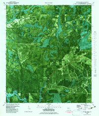
1982 Map of Wetappo Creek
USGS Topo · Published 1983About this map
Wetappo Creek winds through the dense wetlands of Gulf County in this 1982 orthophotomap, which utilizes aerial photography to reveal the intricate hydraulic patterns of the Florida Panhandle. The landscape is defined by vast tracts of inundation, including Bill Swamp and Cerser Swamp, punctuated by elevated land masses such as Martin Island and the Jersey Islands. This specific survey captures the area during a period of transition, where natural drainages like Horseshoe Creek and Sandy Creek meet modern infrastructure. Human presence is marked by the distinct line of the Intracoastal Waterway in the southwest corner, alongside industrial features like a Sandpit and a remote Landing Strip. The map offers a clear view of the drainage network before further development, tracing small tributaries like Britt Branch and Wilburn Branch as they feed into the larger creek systems.
Find a feature on this map
19 named features on this map. Tap any name to fly to it.
Don’t see what you’re looking for? This feature index may not catch every label — zoom into the map to look around manually.
Map Details
Editions of this 1982 Wetappo Creek Map
This is the sole edition of this map. No revisions or reprints were ever made.
Other maps of this area

1943 · Overstreet
USGS Topo · 1:31,680

1944 · Beacon Hill
USGS Topo · 1:31,680

1944 · White City
USGS Topo · 1:24,000

1945 · Dead Lake
USGS Topo · 1:31,680

1945 · White City
USGS Topo · 1:31,680

1945 · Allanton
USGS Topo · 1:31,680

1945 · North Of Allanton
USGS Topo · 1:31,680

1945 · Wewahitchka
USGS Topo · 1:31,680

1945 · Wetappo Creek
USGS Topo · 1:31,680

1945 · Tenmile Swamp
USGS Topo · 1:31,680