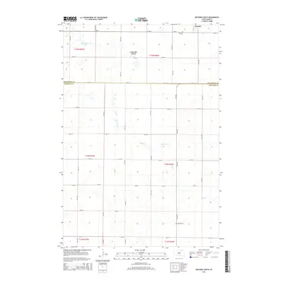
2015 Map of Wetonka South
USGS Topo · Published 2015About this map
Wetonka stands at the northern edge of this landscape, marking a site of settlement in the Glacial Lake Agassiz region where the terrain is defined by numerous prairie potholes and small basins. The survey captures the rural character of the border between McPherson and Edmunds counties, where the township and range grid system dictates the local road network. North of the county line, the Long Lake Colony represents the distinct communal land-use patterns of the region, while landmarks like Wetonka Cemetery and Pembroke Cemetery provide fixed points for genealogical research. West of the townsite, Crompton Lake is one of the few named bodies of water in a territory dotted with unnamed depressions and intermittent wetlands, illustrating the drainage challenges of this high plains environment.
Find a feature on this map
12 named features on this map. Tap any name to fly to it.
Don’t see what you’re looking for? This feature index may not catch every label — zoom into the map to look around manually.
Map Details
Editions of this 2015 Wetonka South Map
This is the sole edition of this map. No revisions or reprints were ever made.
Other maps of this area

1899 · Ellendale
USGS Topo · 1:125,000

1899 · Northville
USGS Topo · 1:125,000

1954 · Aberdeen
USGS Topo · 1:250,000

1956 · Aberdeen
USGS Topo · 1:250,000

1970 · Lake Parmley
USGS Topo · 1:24,000

1970 · Wetonka South
USGS Topo · 1:24,000

1970 · Mina NW
USGS Topo · 1:24,000

1970 · Leola
USGS Topo · 1:24,000
1970 · Richmond SW
USGS Topo · 1:24,000
1970 · Mina
USGS Topo · 1:24,000