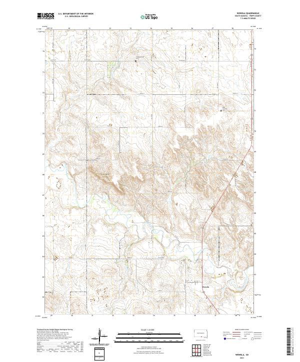
2021 Map of Wewela
USGS Topo · Published 2021About this map
The Keya Paha River meanders across this Tripp County landscape, defining the topography of the southern South Dakota borderlands. Near the river's path, the small settlement of Wewela serves as a primary point of reference for the surrounding rural area. Significant local landmarks include Turtle Butte, a prominent geographic feature that stands out against the rolling prairie terrain. The map documents vital community sites for genealogical research, specifically the Congregational Cem and Hope Lutheran Cem. Water sources like Rahn Lake and Rimber Cr highlight the drainage patterns of the northern plains, while a grid of local roads, such as Co RD 6301 and Musilek Ave, connects the dispersed farmsteads of the region.
Find a feature on this map
31 named features on this map. Tap any name to fly to it.
Don’t see what you’re looking for? This feature index may not catch every label — zoom into the map to look around manually.
Map Details
Editions of this 2021 Wewela Map
This is the sole edition of this map. No revisions or reprints were ever made.
Other maps of this area

1955 · Mitchell
USGS Topo · 1:250,000

1955 · O'Neill
USGS Topo · 1:250,000

1959 · O'Neill
USGS Topo · 1:250,000

1959 · Mitchell
USGS Topo · 1:250,000

1964 · Dallas SW
USGS Topo · 1:24,000
1964 · Meadville NW
USGS Topo · 1:24,000
1964 · Springview NW
USGS Topo · 1:24,000

1964 · Dallas NW
USGS Topo · 1:24,000
1964 · Meadville NE
USGS Topo · 1:24,000

1969 · O'Neill
USGS Topo · 1:250,000